The Final State of the Union
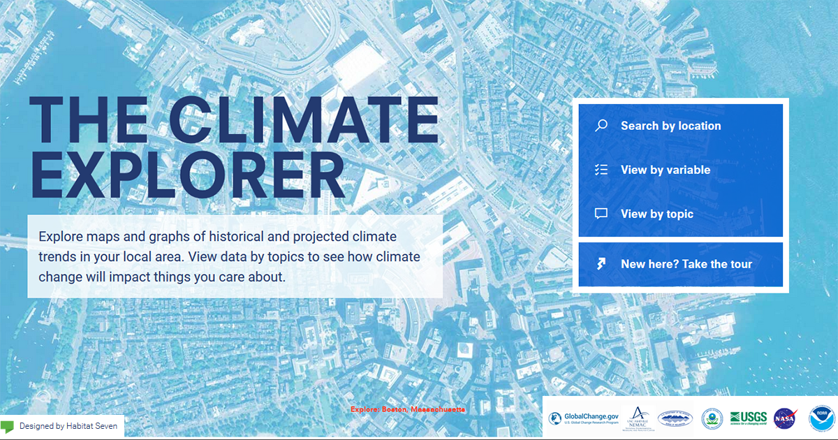
Climate change is a global challenge that will requires local solutions. Today, a new version of the Climate Resilience Toolkit brings climate information to your backyard.
The Toolkit, called for in the President’s Climate Action Plan and developed by the National Oceanic and Atmospheric Administration (NOAA), in collaboration with a number of Federal agencies, was launched in 2014. After collecting feedback from a diversity of stakeholders, the team has updated the Toolkit to deliver more locally-relevant information and to better serve the needs of its users. Starting today, Toolkit users will find:
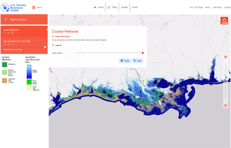
Thanks to the Toolkit’s Climate Explorer, citizens, communities, businesses, and policy leaders can now visualize both current and future climate risk on a single interface by layering up-to-date, county-level, climate-risk data with maps. The Climate Explorer allows coastal communities, for example, to overlay anticipated sea-level rise with bridges in their jurisdiction in order to identify vulnerabilities. Water managers can visualize which areas of the country are being impacted by flooding and drought. Tribal nations can see which of their lands will see the greatest mean daily temperature increases over the next 100 years.
A number of decision makers, including the members of the State, Local, and Tribal Leaders Task Force, have called on the Federal Government to develop actionable information at local-to-regional scales. The place-based, forward-looking information now available through the Climate Explorer helps to meet this demand.
The Climate Resilience Toolkit update builds upon the Administration’s efforts to boost access to data and information through resources such as the National Climate Assessment and the Climate Data Initiative. The updated Toolkit is a great example of the kind of actionable information that the Federal Government can provide to support community and business resilience efforts. We look forward to continuing to work with leaders from across the country to provide the tools, information, and support they need to build healthy and climate-ready communities.
Check out the new capabilities today at toolkit.climate.gov!
Tamara Dickinson is Principal Assistant Director for Environment & Energy at the White House Office of Science and Technology Policy.
Kathryn Sullivan is Under Secretary of Commerce for Oceans and Atmosphere and Administrator of the National Oceanic and Atmospheric Administration.