The Final State of the Union
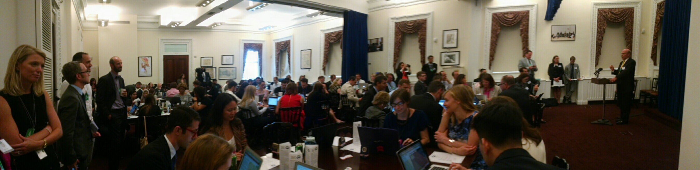
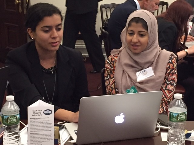
Building on the success of the first White House Mapathon in 2015, last week more than 140 mappers participated in this year’s events at the White House and 15 other locations – in seven states and three countries. The mappers used open geographic data to improve mapping in rural areas of the United States, better identify public transit routes to our Nation’s parks, and prioritize malaria prevention projects around the globe. An additional 1,500 people participated via livestream.
In just three-and-a-half hours, more than 137,000 updates were made to the maps. This includes more than 8,300 buildings and more than 3,700 roads—approximately nine times the work that was done last year in the same amount of time!
All projects for this year’s event were tied to the United Nation’s Sustainable Development Goals – 17 global goals for dignity, prosperity, and justice for all people and the planet. The Administration continues its ongoing support of the creation and use of open geographic data in open mapping efforts, delivering on commitments made in the third Open Government National Action Plan published in October 2015.
Open or crowdsourced mapping describes how millions of people are using collaborative, wiki-like tools to contribute to maps of the world and create shared layers of useful geographic data. Through the use of shared satellite imagery, citizens, governments, the private sector, and academics can support remote mapping—demonstrating the power of collaboration and open innovation. Collaborative mapping is also a valuable approach to engage citizens across the globe to address today’s complex challenges. For youth in particular, it offers an entry point for geographic education and the development of new technology skills.

At the Mapathon, participants worked on a range of projects, including:
Malaria Prevention via OpenStreetMap
Mappers created data that will help malaria programs in Milange, Mozambique as part of the President’s Malaria Initiative’s prevention efforts plan for Fall 2016. In the coming weeks and months, Peace Corps Volunteers in Milange District will work with their Mozambican counterparts to add local knowledge to OpenStreetMap. These updated maps will help anti-malaria organizations better target their efforts and provide project managers with a more realistic understanding of the reality in the field – 53% of this project was completed at the event!
Missing America via OpenStreetMap
Mappers also contributed to the MissingAmerica project, which is an effort led by the U.S. Census Bureau to map remote places across the United States and to improve OpenStreetMap data. Specific tasks ranged from spots in Maine to rural Texas and more – 18% of the Maine project and 47% of the Texas project were mapped at the event.
Humanitarian OpenStreetMap Team Mapping
Remote participants plugged into a variety of international humanitarian open mapping tasks that leveraged U.S. government open data from the Humanitarian OpenStreetMap (HOT) Team. Mappers edited OpenStreetMap for projects ranging from disaster preparedness and relief to longer-term international development and global health initiatives.
Public Transit for Public Lands
For those without private vehicles, accessing public lands and water is a challenge. Mappers worked to identify optimal public transportation routes for select urban centers using information from the Recreation Information Database and other public data sources.
Through the Mapathon, these projects are all open to the broader public and drawing increased support from the open mapping community. As part of the program, Assistant Secretary of State for Educational and Cultural Affairs Evan Ryan spoke about the value of open mapping from the perspective of the U.S. Department of State, and CEO and President of the American Red Cross Gail McGovern shared how the Red Cross has been using open mapping to respond to crisis areas around the world and literally putting underserved populations on the map. Lee Schwartz, Director of the Office of the Geographer and Global Issues at the U.S. Department of State, closed out the day with thoughts on the possibilities that open mapping creates to solving complex global problems.
Participants also heard quick briefs and lightning talks about how open mapping is being used to:
To get more involved and participate in open mapping, please visit mapgive.state.gov to volunteer online or set up your own mapathon event.
The opportunities unleashed by open data and mapping to help others, solve problems, and create opportunities for all are endless. Share your open mapping work, or ideas for how open mapping can be used to solve tangible problems using #WHMapathon!
Courtney Clark is a Program Manager in the Peace Corps Office of Innovation